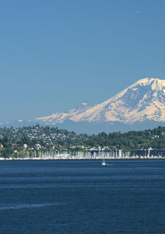

North America Luxury Tours
Designed for the World’s Most Discerning Travelers
A Continent of Extraordinary Beauty and Endless Possibility
North America luxury vacations reveal a world of striking contrasts — from glacier-fed wilderness and desert serenity to cosmopolitan sophistication and coastal elegance. This is a continent that rewards curiosity, offering experiences as vast and varied as the landscapes themselves.
At Travelwizard.com, we design bespoke journeys across the United States, Canada, Alaska, Hawaii, and beyond — where adventure meets refinement, nature blends with culture, and every moment feels effortless.
Whether it’s a private island retreat in Hawaii, a wine country escape in California, a luxury ranch in the Rockies, or an urban sojourn through New York, Vancouver, or San Francisco, your journey unfolds with our signature precision, care, and artistry.
This is North America — curated for those who seek both meaning and magnificence.
The Art of Luxury Travel, Reimagined
Your journey begins with your passions — and we craft every element around them.
You might choose to:
-
Sail between Alaska’s glaciers aboard a private yacht
-
Ride horseback through Montana’s open ranges at a luxury guest ranch
-
Indulge in Michelin-level dining and Napa Valley’s finest vintages
-
Relax on the beaches of Maui or Kauai in a private villa
-
Wander through art galleries, jazz clubs, and architectural icons in Manhattan
-
Discover the serene majesty of Banff, Jasper, or the Canadian Pacific by rail
Your accommodations may include luxury resorts, boutique resorts, exclusive lodges, luxury villas, or Virtuoso-preferred hotels, each hand-selected for its sense of place and flawless service. Every itinerary is individually designed — refined, seamless, and deeply personal.
Signature North American Experiences. We Curate
Hawaii & The Pacific Islands
Private oceanfront villas, helicopter tours, and the spirit of aloha in pure tranquility.
California & The Pacific Coast
Wine country elegance, coastal road journeys, and artistic urban sophistication.
The Canadian Rockies & Alaska
Luxury wilderness lodges, glacier exploration, wildlife safaris, and Northern Lights adventures.
New York, Vancouver & San Francisco
World-class culture, architecture, dining, and the heartbeat of modern refinement.
Rocky Mountain & Western Ranch Retreats
Expansive landscapes, quiet luxury, and authentic western heritage reimagined for the modern traveler.
Private Jet & Rail Expeditions
Journey with grace across iconic landscapes, where the journey itself becomes the destination.
Travelwizard’s North American Legacy
As a Virtuoso member since 1998, we bring:
-
Exclusive access to the continent’s most sought-after resorts and experiences
-
VIP recognition and personal touches at elite properties
-
Private guides, local experts, and insider access to the extraordinary
-
Seamless coordination from start to finish
For over three decades, Travelwizard.com has crafted North American journeys defined not by distance, but by depth, comfort, and connection.
Begin Your North American Journey
Your style.
Your rhythm.
Your story — beautifully told.
Begin Your Private Consultation →

Start with our vacation planner so we can match you with our most suitable travel advisor. We do it all for you, air, car, accommodations, tours, you name, it in a seamless luxury vacation experience you will treasure for a lifetime.


